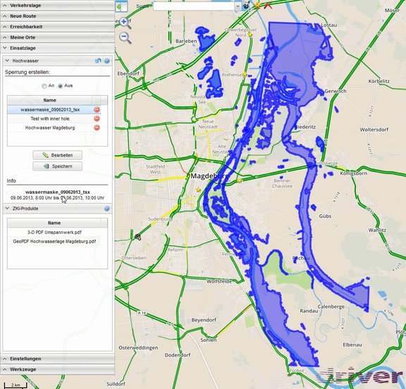
Digital road maps are becoming increasingly important in planning and execution of operations of emergency services. In order to effectively support these operations, comprehensive editing capabilities for the digital cartographic basis were developed as part of the DLR research project VABENE++. This enables a fast and seamless exchange of relevant information for traffic management and logistics operations in disaster situations. Temporary or permanent restriction of the available road network – for example closed roads due to flooding – can now easily be selected, activated or deleted in the user interface by mouse click. The display and management of these restrictions is performed by new extensions developed for the web-based portal “KeepOperational”.
By using standardized interfaces this functionality is seamlessly integrated into the existing system architecture. Furthermore, this enables an automatic notification and consideration of changes in the available road network for all services depending on this digital road network – for example, the routing for emergency vehicles or the analysis of the reachability of strategic places such as assembly areas, guards or hospitals.
In a flood situation, for example, forces from the Agency for Technical Relief (THW) have to plan strategically routes based on the current or forecasted expansion of water masses. The VABENE++ system, on the one hand, provides the derivation of information about the current and expected flood situation on the basis of aerial or satellite images in the form of flood masks. On the other hand, this information be can implemented seamlessly through the developed editing mechanisms directly in the digital road map. In this way, the availability of the roads network infrastructure can be automatically considered by all users of the system for planning tasks and the management of logistics operations.
In future, it is planned to provide this functionality to external systems by developing a web as an interface or as an export function.