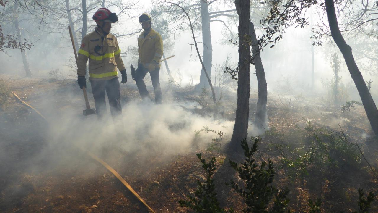
The new Crisis Management System PHAROS was successfully tested under realistic conditions during a wildfire exercise conducted from the 2nd to the 4th of March 2016 jointly with Catalan firefighters and wildfire experts. During the exercise multiple prescribed fires were set and then detected and managed using the PHAROS system. PHAROS is a modular platform that integrates different sources of information and analysis tools into a situational awareness display to aid coordinators and firefighters in rapidly analysing the situation and making appropriate decisions.
The new Crisis Management System PHAROS
PHAROS brings together earth observation data, measurements from sensors in the field, simulation tools and communication technologies in a single platform. This platform is modular and based on a flexible software architecture so that it can be easily expanded to provide additional services. Currently the system is tailored to wildfire management, but it can also be configured for early warning, risk analysis, environmental monitoring, and managing other types of disasters. Besides situation assessment and risk analysis, PHAROS can also be used to alert the public via various communication channels.
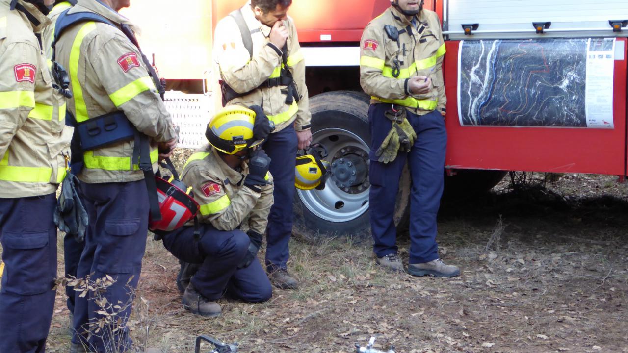
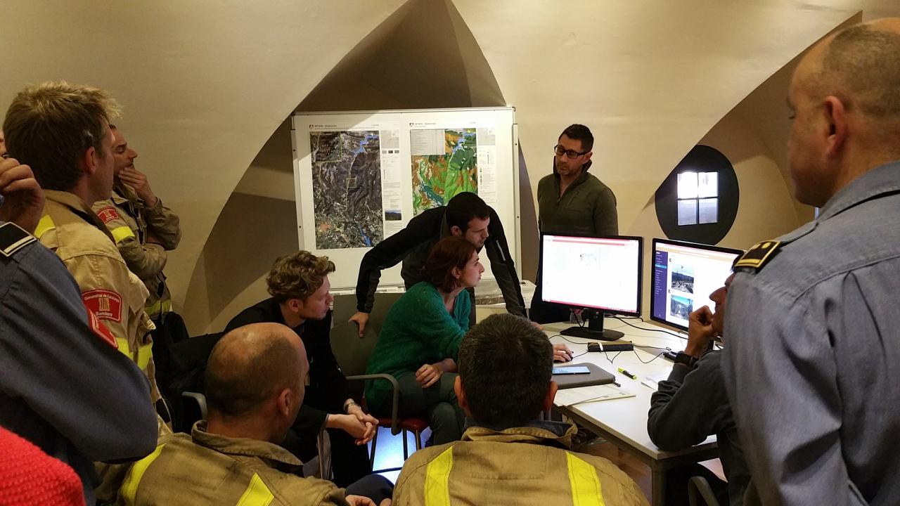
The PHAROS pilot demonstration in the region of Solsona (Catalonia) was supported by regional firefighters (Bombers de la Generalitat de Catalunya) and the Forest Sciences Centre of Catalonia (Centre Tecnològic Forestal de Catalunya, CTFC). A control centre was established at CTFC where firefighters and wildfire experts were able to detect, analyse and assess controlled wildfires using the PHAROS system. Firefighters in the field were also able to access the PHAROS system using mobile devices and contribute local information to augment the common operational picture.
During the wildfire exercise aerial measurements collected above the fire by helicopter-mounted sensors were transferred to the control centre, where they were integrated into the overall operational picture in near real-time. Up-to-date , large-scale situation information was provided in the forms of maps based on a satellite data analysis.
Integration of the data from the helicopter sensors and the satellite-based maps was accomplished in cooperation with the DLR VABENE++ project and the Center for Satellite Based Crisis Information (ZKI) of the Earth Observation Center. In addition to the 4K data also thermal data are collected by the airborne AirSig sensor of the Fraunhofer Institute of Optronics, System Technologies and Image Exploitation (IOSB).
Several DLR institutes and seven European partners are involved in the PHAROS project. The Institute of Communications and Navigation (IKN) has the overall project lead and is responsible for the communication and public alerting aspects. The earth observation and decision support components are provided by the German Remote Sensing Data Center (DFD). Cooperation with the DLR VABENE++ project was facilitated by the Remote Sensing Technology Institute (IMF). Based on the FIREBIRD system of the Institute for Optical Sensor Systems (OS) thermal remote sensing data were recorded by the DLR satellite TET-1.
PHAROS is a project funded by the European Commission under the 7th Framework Programme and runs from December 2013 to May 2016.
ZKI is a service of the German Remotes Sensing Data Center (DFD) at DLR. It provides a 24/7 service for the rapid provision, processing and analysis of satellite imagery relating to natural and environmental disasters, humanitarian relief activities, and civil security issues worldwide.
In the DLR VABENE++ project, powerful tools are being developed to aid public offices and organizations with security responsibilities as well as traffic authorities when dealing with traffic related to disasters and large public events.
Links
- The Remote Sensing Technology Institute (IMF)
- The German Remote Sensing Data Center (DFD)
- ZKI - Center for Satellite Based Crisis Information
- PHAROS Homepage
- Institute of Communications and Navigation (IKN)
- ZKI: Rapid Mapping products for the exercise
- Forest Sciences Centre of Catalonia
- Fraunhofer IOSB
- FIREBIRD system of the Institute for Optical Sensor Systems (OS)