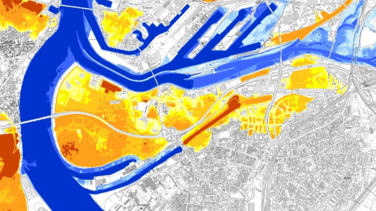
Flooding in Duisburg. The water level rises continuously and then the floodgate fails. On 30 March 2017 the crisis management team of the city of Duisburg practiced responding to this scenario in order to be ready for such an emergency. EOC staff participated in the drill as observers and collected information on the disaster response as part of the VABENE++ project. This is because the 4k camera system developed at EOC is designed for use in future emergency situations like this one. Thanks to on-board real-time processing, images from the camera, which is mounted on a helicopter, are immediately available to emergency relief teams on the ground. Even information on the momentary traffic situation and highly precise surface models are promptly provided by the camera system. The data collected by the camera flow into a situational awareness system developed as part of VABENE++, where they can be viewed as a display and directly printed out as a map. During the crisis management drill itself the 4k camera remained on the ground for organisational reasons. It will be demonstrated to a suitable delegation from Duisburg during a visit to EOC.
The scenario tested in Duisburg is realistic. If the floodgate fails, the inner harbour could be flooded along with nearby offices and housing. If the water continued to rise, a home for the elderly, a transformer station, the state office for centralised police services and other critical infrastructure could be affected. Can the water masses be contained? What measures are required? What are the likely consequences? The population has to be informed, street barriers erected and evacuation organised. Numerous decisions need to be made and implemented in the shortest possible time by the crisis management teams responsible for administration and organisation. A standardised situational awareness overview with up-to-date aerial images, traffic prognoses, as well as analytical and simulation software tools is a valuable contribution to the efforts of crisis units.
In the DLR VABENE++ project, tools are being developed to support public authorities, organizations with responsibilities for assuring public safety, and traffic authorities in dealing with disasters and mass public events. The goal is to efficiently guide the rescue logistics and nearby traffic streams even under extreme conditions so that rescue teams can rapidly get to their destinations. The focus of research includes the areas of simulation and large-scale traffic modelling, aerial traffic monitoring, traffic risk assessment, data fusion, data management, and further developing GIS-related web technologies.

