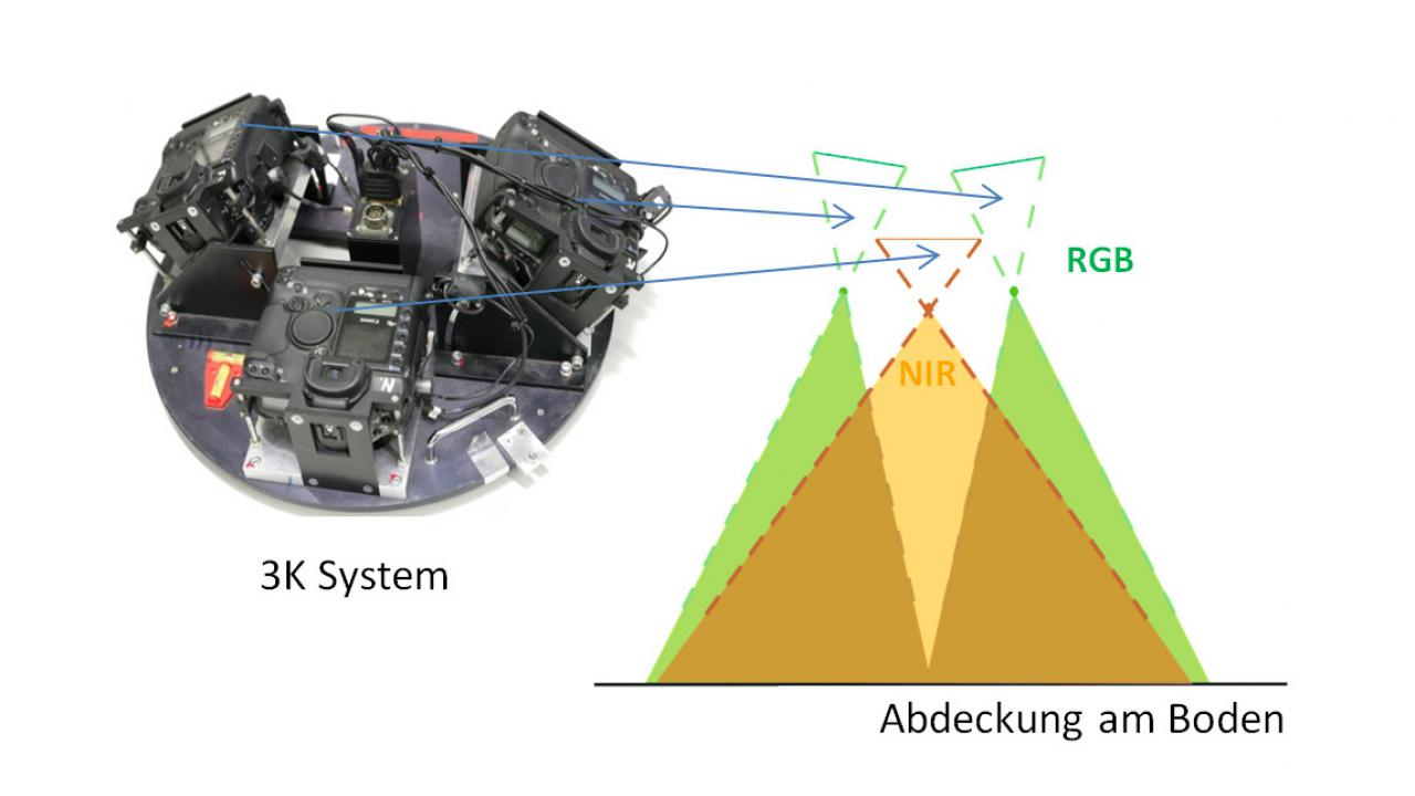
Floods are one of the natural disasters most common in Germany. Especially for rescue teams and BOS units it is important to know quickly and accurately the affected areas and streets. To be able to detect water surfaces reliably, the spectrum of the 3K sensor system has been extended by the near infrared channel. Figure (1) shows the arrangement of the cameras with a modified and in the near infrared sensitive camera in vertical viewing direction. With this arrangement, an overall picture with four bands red, green, blue, and near infrared can be derived/captured.
As water surfaces can be easily discriminated from other land cover types in the near infrared domain, this spectral extension of the camera system will be utilized to develop methods and processors for automatic water extraction. The water detector will be mainly applied in case of flood events in order to rapidly provide information on flooded areas and affected infrastructure to rescue teams and coordination centres.
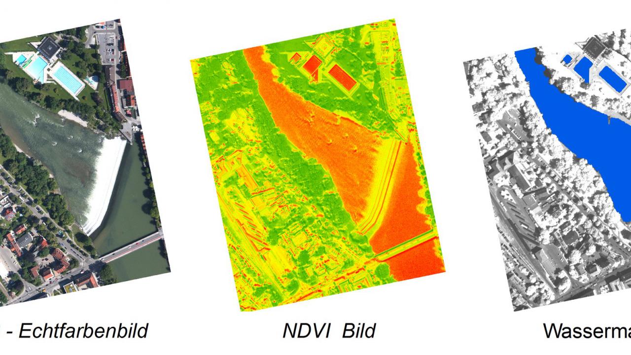
Figure 2 shows a true colour composite image (left) and a coloured image of the Normalized Difference Vegetation Index – NDVI (middle), exemplified for the city centre of Landsberg am Lech (Germany). The spectral index is derived from the red and near infrared channels. The extracted water mask on the right was derived using an image based classification approach based on the NDVI. This method will be the basis for an automatic water detection processor to be developed within the project.