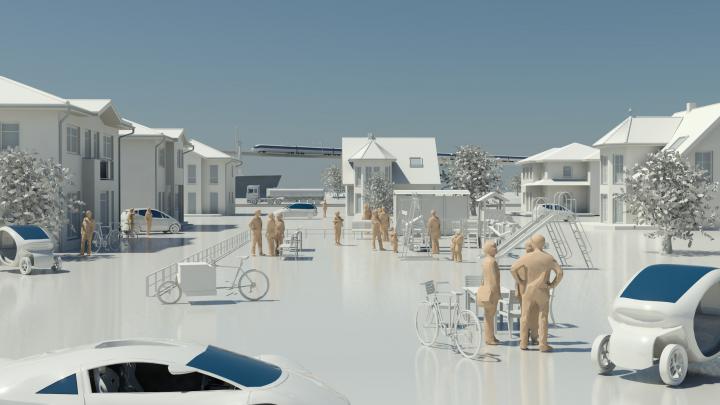
Verkehrssystem

Mobilität ist ein zentrales Merkmal entwickelter Gesellschaften. Der Transport von Personen und Gütern erzeugt neben gesellschaftlicher Teilhabe und Wertschöpfung aber auch negative Effekte, die es zu minimieren gilt. Daher erforscht das Deutsche Zentrum für Luft- und Raumfahrt (DLR) die Zusammenhänge von Verkehrsentwicklung und Verkehrswirkungen in ihren unterschiedlichen Dimensionen. Hierzu gehören unter anderem die Analyse von Nutzerpräferenzen und Nutzerverhalten, die Entwicklung des Verkehrsangebots wie auch der -nachfrage und die induzierten Umweltwirkungen durch Lärmemissionen, Klimagase und Luftschadstoffe.

Zusammenspiel unterschiedlicher Verkehrsträger

Besonderes Augenmerk legt das DLR dabei auf die Entwicklungen im urbanen Raum und das Zusammenspiel der unterschiedlichen Verkehrsträger, bis hin zu Fuß- und Radverkehren. Im Fokus der Forschung stehen auch die zunehmende Automatisierung und Digitalisierung des Verkehrssystems, die damit verbundenen Chancen und Risiken sowie die elementare Verknüpfung von Energie und Verkehrssystem zur Entwicklung einer nachhaltigen Mobilität.

Für die zielgerichtete Entwicklung intermodaler Verkehre ist die effiziente Ausgestaltung von Umsteigeprozessen oder Umschlagsvorgängen ein wesentlicher Faktor, dem sich das DLR bei der Untersuchung von Verkehrsknoten wie Bahnhöfen und Seehäfen verstärkt widmet. Zur wirtschaftlichen Bewertung neuer Technologien und politischer Maßnahmen mit deren Auswirkungen für den Verkehr,  entwickelt das DLR ökonomische Modelle und Methoden, um Kosten und Nutzen differenziert und belastbar darlegen zu können.

Projekte

Air2X

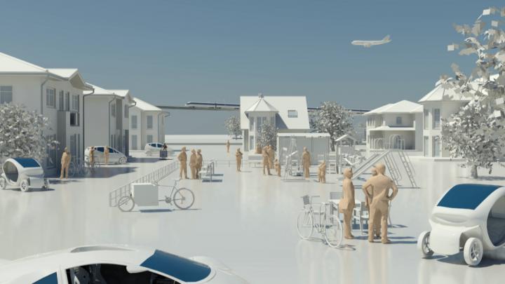
Digitalisation is fundamentally changing our mobility in many areas. In addition to self-driving cars, airborne drones are playing an ever-increasing role in an automated and connected transport system of tomorrow. Possible applications include the transport of vital medical...

VABENE++

The goal is to efficiently manage the required rescue logistics and the nearby traffic flow even under extreme conditions, thereby enabling response teams to rapidly reach the locations where they are needed. Research focuses on such areas as simulation and large-scale traffic...

Transport and the Environment

Focused expertise for a sustainable transport system How will we be mobile in tomorrow´s world? What options do we have to develop transport more sustainably? A network of twelve research institutes overseen by the German Aerospace Center (DLR) is researching those and other...

Aktuelles

Waiting or Parking?

05.02.2018 · Großereignis- / Katastrophenmanagement
In the VABENE++ project, traffic information is collected automatically from aerial photographs. An approach has now been developed to separate parking from queuing vehicles, thus improving the quality of the results.

Swarmtool in Action

18.01.2018 · Großereignis- / Katastrophenmanagement
VABENE++ has developed a system for an area-wide mapping of larger areas that allows the simultaneous operation of several multicopters at the same time. The Swarmtool has now been extensively tested and optimized.

Uninterruptible Data Transmission via Laser

18.01.2018 · Großereignis- / Katastrophenmanagement
In the VABENE++ project enormous amounts of data are generated during aerial photography flights. In order to be able to send them quickly and without interruptions to the ground, a hybrid link has been developed that enables transmission both by laser and radio transmission and...

Bluetooth Sensors for Traffic Management

18.01.2018 · Großereignis- / Katastrophenmanagement
Vabene++ supports the city of Constance in collecting traffic data using its own bluetooth sensor technology. The data obtained flows into a simulation model for the evaluation and optimization of traffic management measures.

When Multicopters Swarm Out

18.01.2018 · Großereignis- / Katastrophenmanagement
More and more multicopters are being used to gain an overview of the situation in crisis situations. In order to record larger areas or different locations at the same time, VABENE++ is developing the Swarmtool, which is used to control swarms of such multicopters.

A 3D Model in 2 Seconds

18.01.2018 · Großereignis- / Katastrophenmanagement
3D Information can now be derived from aerial imagery within seconds to serve applications of the project VABENE++.

Microdrones as mobile sensor platforms for disaster relief scenarios

04.12.2015 · Großereignis- / Katastrophenmanagement
Among other things, the current activities in VABENE++ include a study of micro aerial vehicles (MAVs; see Fig. 1) for potential applications in disaster relief and monitoring of large events. Fig. 1: Image of a Quadrotos MAV as they are used at the Insititute of Communications...